Drone Roof Inspection in Peoria, AZ
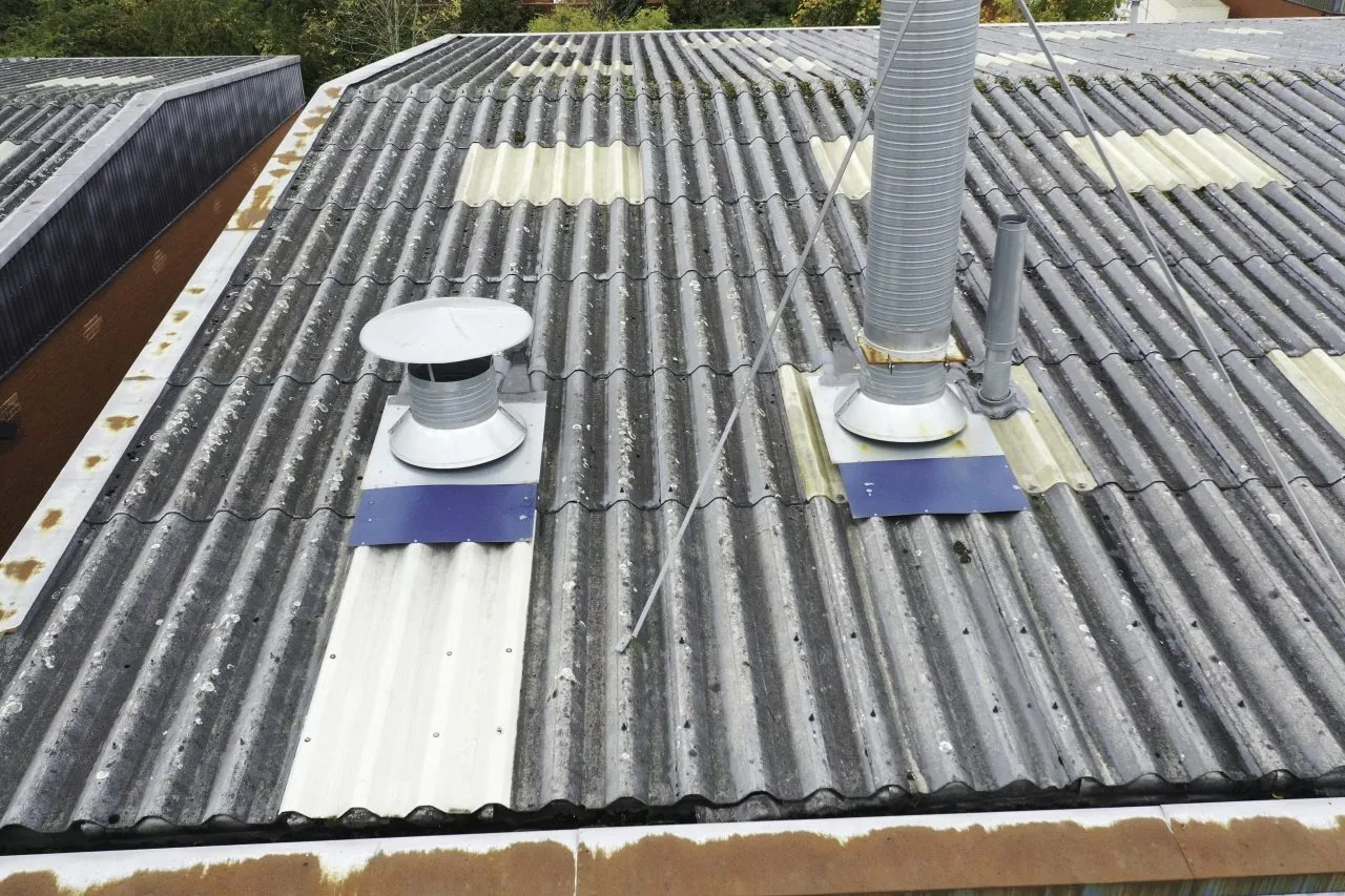
A broad overhead view can make a roof layout easier to read, but it cannot confirm every seam or hidden layer. In Peoria, AZ, heat exposure and monsoon conditions make perimeter metal, rooftop equipment, drains, and transitions useful points to compare across a large roof. We use drone imaging to capture selected surfaces and hard-to-reach elevations, then connect those views to hands-on checks where close inspection is needed. The owner receives images tied to roof areas, not a set of pictures without a repair decision. A full commercial roof inspection can add direct observations and moisture testing when the image leaves a question open.
Map the roof before flying a pass
We start by defining the question the images should answer. A wide roof may need a view of drainage layout, repeated curb conditions, edge continuity, coating coverage, or sections blocked from a safe walking path. We review the site access, roof dimensions, nearby obstacles, flight conditions, and any sensitive operations before capture. If a view cannot resolve a detail, we mark it for closer inspection instead of filling the gap with an assumption.
Peoria’s Loop 303 employment corridor is planned across commercial and business or industrial uses, making roof layout and equipment density a practical inspection question for properties there. The corridor’s planning designation does not establish any individual roof condition. We create the image plan from the actual building and owner priorities. When a roof has multiple sections, image labels follow those areas so a facility team can compare them against service records or a condition report.
Use images to locate, not diagnose, a defect
Overhead photos can show surface interruptions, visible patch patterns, standing water, debris, displaced objects, and changes near edges or penetrations. A dark area is not automatically wet insulation; a bright surface does not prove the membrane is intact. We annotate observations that warrant a closer look and keep the conclusion proportional to the image. A suspected seam opening or curb issue still needs direct review before repair material or scope is selected.
At P83, commercial, entertainment, and hospitality uses can create active access constraints around a roof. We coordinate launch and observation points to avoid interfering with customers or deliveries, then keep imagery focused on the roof inspection. If the purpose is to compare a large roof before and after maintenance, we can use consistent section labels and capture angles where conditions allow. A repair or maintenance visit can be planned after the image review, rather than treating the drone pass as the work itself.
Review areas that need a safer vantage
Some roof sections are difficult to walk because of height changes, fragile surfaces, equipment congestion, or limited safe access. A drone can help observe their visible layout while keeping personnel off a questionable area. We still identify what remains unseen: underlayment, insulation, deck condition, concealed flashing, and the underside of a detail do not become known from an exterior image.
Peoria’s North Peoria planning area extends along Loop 303 toward State Route 74, and the city describes a long-term mix of employment, commercial, residential, and open-space uses. That context may bring roofs with different site access and phasing needs as projects proceed, but a plan is not evidence that a parcel is built or occupied. We inspect the current property as it exists. Where an operational area sits beside a restricted zone, the owner can use an aerial overview to decide where a hands-on inspection is both necessary and safe.
Choose a weather window that preserves detail
Wind, heat shimmer, glare, and cloud cover can reduce image usefulness or make flight unsafe. Arizona monsoon guidance describes damaging winds and microbursts, while hail and brief heavy rain are also regional storm concerns. We check conditions before imaging and reschedule if wind or precipitation prevents a safe, clear pass. The inspection note records the capture window and any roof area that could not be covered. That keeps a partial set from being mistaken for a complete roof assessment.
Phoenix historical climate records average many days with high temperatures at or above 100°F, a regional air-temperature statistic rather than a surface reading. Heat can affect equipment and operator limits, as well as image quality over a hot roof. We plan capture timing accordingly and review the resulting images for glare, blur, and missing sections. When a roof issue is active during a weather event, emergency protection takes priority over collecting imagery. After conditions improve, a documented emergency visit and a drone overview can support different steps in the same response.
Pair the overview with a field decision
The image review should end with an action list. We identify which areas appear serviceable, which need close inspection, and which observations may warrant repair or testing. For a suspected wet section, infrared readings or selected core cuts provide a different kind of evidence. For a visible tear or open seam, a hands-on visit can confirm preparation and repair limits. The owner can see how each next step follows from what the image shows, without confusing visual coverage with a warranty opinion or moisture diagnosis.
A roof near Camino a Lago may have a different access pattern than one in an established employment district. The adopted plan describes a concentrated commercial core within a broader north Peoria area, but it does not identify a particular building’s current roof or use. We make the imaging plan around the property’s present layout and coordinate with its contact. If inspection confirms a localized failure, we can prepare a targeted repair; if it reveals a wider pattern, we can map a moisture survey or replacement evaluation.
Keep the images tied to roof history
We label files by building and roof section and retain a short record of the purpose, coverage, and limitations of the capture. That lets the property team compare later views with the same roof areas instead of sorting through unlabeled photos. If a repair is completed, the image set can support a before-and-after record. We can also note recurring debris, surface movement, or changes around equipment that should be checked during planned maintenance. The images complement the written findings; they do not replace the crew’s inspection notes.
For owners with buildings in Peoria and Surprise, comparable labels can simplify portfolio review while preserving each property’s own condition history. We connect each observation to an action and avoid carrying a finding from one roof to another. A capital planner can then compare the areas that need repair, testing, or a future budget window. The replacement review or capital plan begins with verified condition, not the number of images collected.
Commercial Roofing Questions
Can drone images confirm a roof leak?
They can help locate visible openings, drainage issues, or surface changes, but they cannot confirm every water path or concealed wet area. We pair images with interior reports and hands-on inspection. If the suspected area is below the surface, moisture testing or a selective core cut may be necessary.
Does a drone pass replace a roof walk?
No. Aerial images provide coverage and perspective, while a field inspection checks material condition, seams, and details at close range. We identify areas the drone cannot resolve and make a safe access plan for follow-up. The scope depends on the question the owner needs answered.
What roofs benefit most from aerial imaging?
Large roofs, sections with limited walking access, and properties where layout or repeated details are hard to compare from one point can benefit. We determine whether imagery will answer a specific question before capture. If the roof is small and accessible, a hands-on inspection may be the more useful first step.
Can you fly during monsoon weather?
We will not fly when wind, rain, lightning, or visibility makes the operation unsafe or the images unreliable. We check conditions and select a clear window. If water is actively entering the building, stabilization and occupant protection come before an aerial survey.
What do we receive after the flight?
The owner receives images organized by roof area, a note of coverage limits, and observations that merit closer review. We distinguish visible conditions from conclusions that require a hands-on check. Any recommended repair or moisture test is tied to the area shown, so the next visit can be scheduled efficiently.